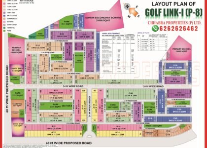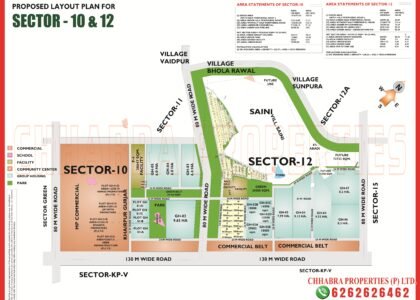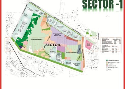

If you are planning to buy a plot, a builder floor or a flat in Greater Noida, the first thing you need is a clear Greater Noida sector map. Unlike Noida, where sectors are mostly numbered, Greater Noida uses Greek letters such as Alpha, Beta, Gamma, Delta, Omicron, Pi and Chi-Phi, along with numbered sectors in Greater Noida West and industrial pockets named Ecotech, Udyog Kendra and Surajpur Site. Without a map, it is easy to get lost.
In this guide, the Chhabra Properties team — working from our office in the Alpha 1 Commercial Belt — walks you through how the city is planned, where every sector group sits on the map, and how to use our free, high-resolution Greater Noida sector maps before you visit a property.
How Greater Noida Is Planned
Greater Noida is a planned city in Gautam Buddha Nagar district of Uttar Pradesh, developed by the Greater Noida Industrial Development Authority (GNIDA), which was set up in 1991 under the UP Industrial Area Development Act, 1976. From the very first master plan the city was designed with wide arterial roads (often 60 m, 45 m and 30 m wide), large green belts and clearly separated land uses — residential, industrial, institutional, commercial and recreational.
That separation is exactly why a sector map matters. When you look at any Greater Noida map you will notice that residential sectors are grouped together in the central and western parts of the city, institutional zones (Knowledge Parks) are close to Pari Chowk, and industrial sectors are spread along the eastern and southern edges towards Surajpur, Kasna, Dadri and Sikandrabad.
When Greater Noida was formed, sectors were named after Greek letters — Alpha, Beta, Gamma, Delta and so on — with numbers like 1, 2 and 3 added to each. In 2022 GNIDA gave in-principle approval to a proposal to rename residential sectors with numbers, but the Greek names remain what residents, lease deeds and property dealers use every day, so our maps use the familiar names.

Sector Groups on the Greater Noida Map
The easiest way to read the city is to think in groups rather than individual sectors. The table below summarises the main groups you will see on the Greater Noida map and what each is best known for.
| Sector group | Examples | Typical use | Map page |
|---|---|---|---|
| Alpha | Alpha 1, Alpha 2 | Plotted residential, commercial belt, metro | Alpha 1 map, Alpha 2 map |
| Beta | Beta 1, Beta 2 | Plotted residential, Jagat Farm side | Beta 1 map, Beta 2 map |
| Gamma | Gamma 1, Gamma 2 | Premium plotted housing, Jagat Farm market | Gamma 1 map, Gamma 2 map |
| Delta | Delta 1, 2, 3 | Plotted residential, metro station | Delta 1 map, Delta 3 map |
| Omicron | Omicron 1, 1A, 2, 3 | Plots + group housing, newer layouts | Omicron 1 map, Omicron 3 map |
| Pi / Chi-Phi | Pi 1 & 2, Chi, Phi | Residential near Pari Chowk & Knowledge Parks | Pi 1 & 2 map, Chi Phi map |
| Numbered sectors | Sector 1–4, 16, 16B, 16C, 36, 37 | Greater Noida West (Noida Extension) & older numbered sectors | Sector 36 map |
| Industrial | Ecotech, Udyog Kendra, Surajpur Site B/C/IV/V | Factories, warehousing, industrial plots | Ecotech 3 map, Surajpur Site B map |
Residential Sector Maps of Greater Noida
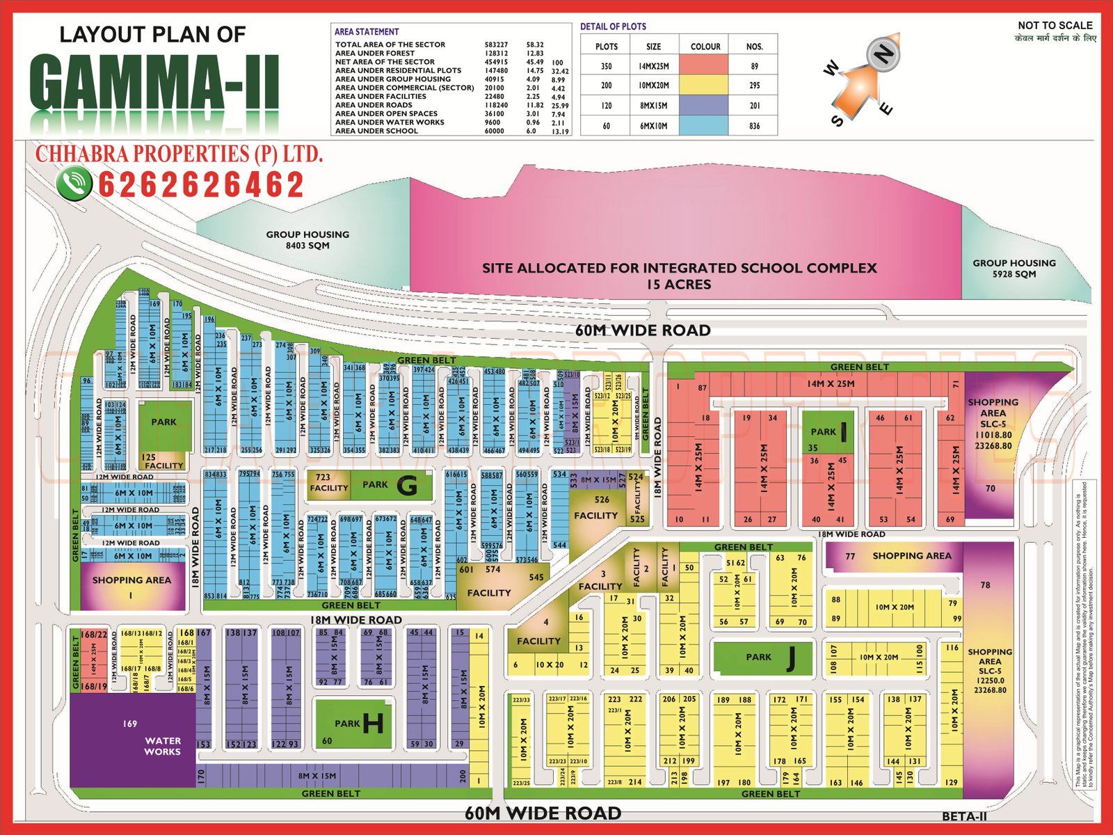
Residential sectors make up the heart of the Greater Noida map. Most of them follow a similar planning pattern: the sector is surrounded by wide sector roads, divided into lettered blocks (A, B, C, D…), and each block contains numbered plots facing internal roads, with parks, a community centre, a school site and a convenience shopping area placed inside the sector.
Alpha, Beta and Gamma – the original core
These were among the first sectors to be developed and are now fully settled. The Alpha 1 map shows a mix of residential blocks and the Alpha commercial belt, which today is one of the busiest market areas of the city. Gamma 1 houses the well-known Jagat Farm market, and Gamma 2 map is often described as one of the more premium plotted sectors.
Delta, Pi and Chi-Phi – around the metro and Pari Chowk
Delta 1, Delta 2 and Delta 3 sit along the Aqua Line metro corridor, with a metro station named after Delta 1. Pi 1 & 2 and Chi-Phi lie close to Pari Chowk and the Knowledge Park belt, which keeps rental demand from students and professionals steady.
Omicron, Mu, Xu, Sigma, Eta and Zeta – the newer ring
These sectors were developed later and offer bigger plots, newer layouts and group-housing pockets. On the map you will notice wider internal roads and larger green areas. Omicron 1 and 1A, for example, now have both plotted housing and well-known group housing projects.
Industrial and Institutional Maps
A large share of Greater Noida’s planned area is industrial. Ecotech sectors, Udyog Kendra, Surajpur industrial sites and the UPSIDC areas around Sikandrabad are shown separately on our maps because buyers there look for very different information — plot size in square metres, road frontage, and distance to highways and freight routes. Institutional zones such as the Knowledge Parks host universities, colleges and hospitals, which is why the residential sectors around them stay in demand for rent.
If you are looking for industrial land, start with the Ecotech 3 map, Surajpur Site B map and Omicron 1 Udyog Kendra map pages.
Roads and Metro on the Greater Noida Map
- Noida–Greater Noida Expressway connects Noida to Pari Chowk, the main gateway of Greater Noida.
- Yamuna Expressway starts near Pari Chowk (Zero Point) and leads towards the Noida International Airport at Jewar.
- Aqua Line metro (opened on 25 January 2019) runs from Noida Sector 51 to Depot station, with Greater Noida stations including Knowledge Park II, Pari Chowk, Alpha 1, Delta 1, GNIDA Office and Depot.
- Eastern Peripheral Expressway and the Dadri/Kasna side connect the industrial areas with freight routes.
When you study a sector map, check which side of the sector faces a main road and how far the nearest metro station is — these two factors make a big difference to resale value and rental demand.
How to Use a Sector Map Before Buying Property
- Locate the block and plot number. Every listing should give you a block letter and plot number. Find it on the sector map.
- Check road width and facing. Corner plots, park-facing plots and plots on wider roads usually command a premium.
- Look at the land use around the plot. Is it next to a school site, a commercial pocket or a green belt?
- Measure distance to metro and main roads using the Google Map below or the map viewer on our sector pages.
- Verify with GNIDA records. Always cross-check the lease deed, allotment letter and the latest authority records.
Greater Noida on Google Maps
Use the live map below to explore Greater Noida, zoom into any sector and compare it with the layout maps on our website.
Why Use the Chhabra Properties Greater Noida Sector Map Collection?
Most websites show one blurry image of the whole city. Our Greater Noida sector map collection gives each sector its own page with a zoomable, high-resolution layout, JPG and PDF downloads, nearby landmarks and FAQs. That means you can open the exact sector map you need on your phone while standing at the plot. Today the collection covers more than 60 Greater Noida maps — Alpha, Beta, Gamma, Delta, Eta, Zeta, Sigma, Omicron, Mu, Xu, Pi, Chi-Phi, numbered sectors, Golf Link, NRI City, Ecotech, Knowledge Park, Techzone, Surajpur and Sikandrabad industrial areas.
We also publish the Noida sector map series and the Yamuna Expressway map series, so you can compare Greater Noida with Noida and the airport belt in one place.
Explore Related Greater Noida Maps
- Alpha 1 map
- Beta 1 map
- Gamma 2 map
- Delta 1 map
- Omicron 1 map
- Pi 1 & Pi 2 map
- Chi Phi Extension map
- Sector 36 map
- All Greater Noida sector maps
- Yamuna Expressway maps
- Noida sector maps
Frequently Asked Questions
Where can I download the Greater Noida sector map PDF?
You can view and download sector-wise maps for free on the Chhabra Properties Greater Noida map page. Each sector page has a zoomable map, a JPG and a PDF download.
Why are Greater Noida sectors named Alpha, Beta, Gamma?
When GNIDA planned the city in the early 1990s, residential sectors were named after Greek letters with numbers added (Alpha 1, Alpha 2 and so on). A proposal to switch to numbers got in-principle approval in 2022, but the Greek names are still commonly used.
Which authority manages the Greater Noida map?
The Greater Noida Industrial Development Authority (GNIDA) plans and manages land use, allotments and layouts in Greater Noida.
Which Greater Noida sectors have metro stations?
The Aqua Line has stations at Knowledge Park II, Pari Chowk, Alpha 1, Delta 1, GNIDA Office and Depot in Greater Noida.
Is Greater Noida West part of the Greater Noida map?
Yes. Greater Noida West (Noida Extension) falls under GNIDA and mainly uses numbered sectors such as Sector 1, 2, 3, 4, 16, 16B, 16C, 36 and 37.
Note: Maps on this page are for reference and planning. Plot numbers, land use and road widths should always be verified with the latest Greater Noida Industrial Development Authority (GNIDA) records and the property’s lease deed before any transaction.
Need the Latest Greater Noida Map or a Site Visit?
Chhabra Properties works from its own office in the Alpha 1 Commercial Belt and helps buyers, sellers and investors with plots, houses, floors and flats across Greater Noida. Ask us for the latest layout, plot availability or a guided site visit.
Office: 204, S L Tower, Alpha-I Commercial Belt, Greater Noida, Uttar Pradesh 201310