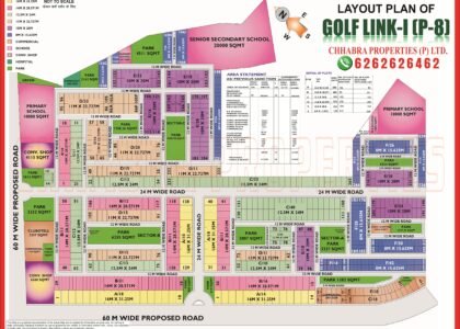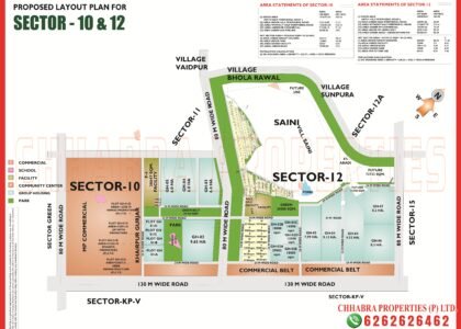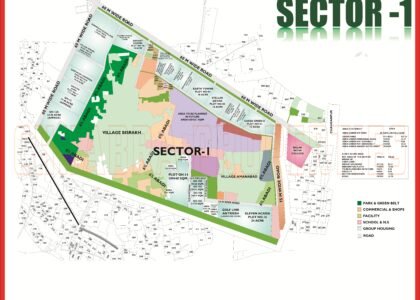

The Greater Noida Master Plan 2041 is the blueprint that decides how the city will grow over the next two decades — where new homes will come up, where industries will be allowed, how much land will stay green and which roads will be widened. For anyone buying property here, understanding the Greater Noida master plan 2041 map is as important as checking the sector layout map.
This article explains the key numbers and zones in simple language and shows how the master plan connects with the individual Greater Noida sector maps on our website.
What Is the Greater Noida Master Plan 2041?
A master plan is a long-term land-use plan prepared by a development authority. For Greater Noida, it is prepared by GNIDA under the UP Industrial Area Development Act, 1976. Earlier plans (Master Plan 2001 and Master Plan 2021) guided the development of today’s sectors — Alpha, Beta, Gamma, Delta, Omicron, Knowledge Parks, Ecotech and Greater Noida West. Master Plan 2041 builds on these and plans for the next phase of growth, which is closely linked to the Noida International Airport at Jewar and the industrial corridors around it.
On a master plan map every parcel of land is colour-coded: yellow shades for residential, purple/violet for industrial, blue for institutional, red for commercial and green for parks and green belts. Roads are shown with their planned widths.
Key Numbers of Master Plan 2041
| Parameter | As reported for Master Plan 2041 |
|---|---|
| Approval | GNIDA board, August 2023 |
| Current planned area | About 31,733 hectares |
| Planned area by 2041 | About 71,733 hectares |
| Population capacity | More than 40 lakh people |
| Industrial land | Over 14,000 hectares |
| Residential land | Over 9,700 hectares |
| Green / recreational land | Over 8,900 hectares |
Figures are based on published reports of the approved plan; for statutory use always refer to the official GNIDA notification and map.

Land-Use Zones You Will See on the Master Plan Map
Residential
The existing residential belt — Alpha, Beta, Gamma, Delta, Pi, Chi-Phi, Omicron, Mu, Xu, Sigma, Eta, Zeta and the numbered sectors of Greater Noida West — remains residential. New residential sectors are planned in the expansion areas, which is where future plotted schemes and group housing are likely.
Industrial
Industry is the single largest land use in the plan. Existing industrial sectors like Ecotech, Udyog Kendra and Surajpur continue, while new industrial land is planned to support manufacturing, logistics and data-centre type uses.
Institutional and commercial
Knowledge Parks remain the education and health hub. Commercial belts like the Alpha 1 Commercial Belt and Jagat Farm market are part of the existing fabric, and new commercial nodes are planned along major roads and metro stations.
Green belts
Green belts along major roads and drains, city parks and sector parks keep Greater Noida one of the greener cities in NCR. When you look at a sector map, plots facing these green belts are often more valuable.
Greater Noida Phase-II
The biggest change in Master Plan 2041 is the proposal to develop Greater Noida Phase-II on roughly 40,000 hectares of land, much of which is currently agricultural and would need to be acquired. Development in such areas happens over many years, so buyers should check the status of land acquisition and approvals before investing in any project that is marketed as being in a “new master plan area”.
Connectivity in the Plan
- Strengthening links with the Yamuna Expressway and Noida International Airport.
- Widening of key roads and better connections to the Eastern Peripheral Expressway.
- Metro extensions have been discussed for Greater Noida West and the Knowledge Park side; the existing Aqua Line already serves Pari Chowk, Alpha 1, Delta 1 and GNIDA Office.
What Master Plan 2041 Means for Property Buyers
- Established sectors gain from scarcity. Developed sectors like Alpha 1, Gamma 2 and Delta 1 have limited supply and ready infrastructure.
- Newer sectors offer growth. Sectors like Omicron 1 and Omicron 3 have more room for appreciation as the city grows towards the airport.
- Check land use before you buy. A plot shown as residential on a sector map must also be residential on the master plan.
- Be careful with “future” projects. Projects in proposed areas depend on acquisition and approvals.
Master Plan Map vs Sector Map: What’s the Difference?
The master plan map is a city-level map showing land use zones and major roads. A sector map zooms into one sector and shows blocks, plot numbers, internal roads, parks and facility sites. You need both: the master plan tells you what an area is meant for, and the sector map tells you exactly where your plot is. All our sector maps are listed on the Greater Noida map page, and for the airport side see our Yamuna Expressway maps.
How to Read the Greater Noida Master Plan 2041 Map
When you open the Greater Noida master plan 2041 map, first locate familiar anchors — Pari Chowk, the Noida–Greater Noida Expressway, the Yamuna Expressway and the Aqua Line corridor. Then follow the colour legend to identify residential, industrial, institutional, commercial and green zones. Finally, zoom into your area of interest and switch to the matching sector map on our website to see the actual blocks and plots.
- Thick lines are master plan roads; their planned width is usually printed alongside.
- Hatched or dotted areas often indicate proposed or future development.
- Village abadi areas are typically shown separately from planned sectors.
A master plan 2041 map is a planning document, not a sale document — the land use shown for a parcel must be matched with its lease deed and GNIDA records before you buy.
Explore Related Greater Noida Maps
- Alpha 1 map
- Delta 1 map
- Omicron 1 map
- Omicron 3 map
- Pi 1 & Pi 2 map
- Ecotech 3 map
- All Greater Noida sector maps
- Yamuna Expressway maps
- Noida sector maps
Frequently Asked Questions
When was the Greater Noida Master Plan 2041 approved?
It was approved by the GNIDA board in August 2023.
What is the planned area under Master Plan 2041?
As reported, the planned area grows from about 31,733 hectares to about 71,733 hectares, largely through a proposed Greater Noida Phase-II.
How many people is Greater Noida planned for by 2041?
The plan is designed for a population of more than 40 lakh people.
Where can I see sector maps that fit into the master plan?
All sector-wise layout maps are available on the Chhabra Properties Greater Noida map page.
Does Master Plan 2041 change existing sectors?
Existing developed sectors largely keep their land use. The main changes are new areas, new industrial land and connectivity upgrades. Always verify specific plots with GNIDA.
Note: Maps on this page are for reference and planning. Plot numbers, land use and road widths should always be verified with the latest Greater Noida Industrial Development Authority (GNIDA) records and the property’s lease deed before any transaction.
Need the Latest Greater Noida Map or a Site Visit?
Chhabra Properties works from its own office in the Alpha 1 Commercial Belt and helps buyers, sellers and investors with plots, houses, floors and flats across Greater Noida. Ask us for the latest layout, plot availability or a guided site visit.
Office: 204, S L Tower, Alpha-I Commercial Belt, Greater Noida, Uttar Pradesh 201310