Golf Link and Pocket P3, P4 Greater Noida Map: Plot Sizes, Roads and PDF
Golf Link I and II plus Pocket P3 and P4 Greater Noida map with plot sizes, plot counts, roads, group housing sites and free PDF download. Call +91 62626 26462.

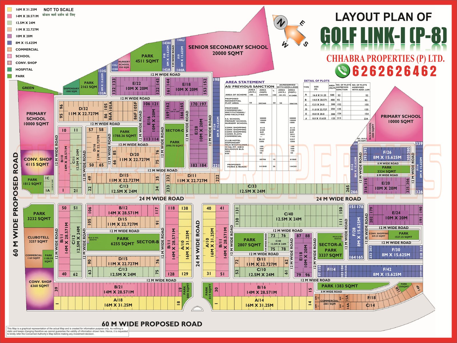
Golf Link I and II plus Pocket P3 and P4 Greater Noida map with plot sizes, plot counts, roads, group housing sites and free PDF download. Call +91 62626 26462.
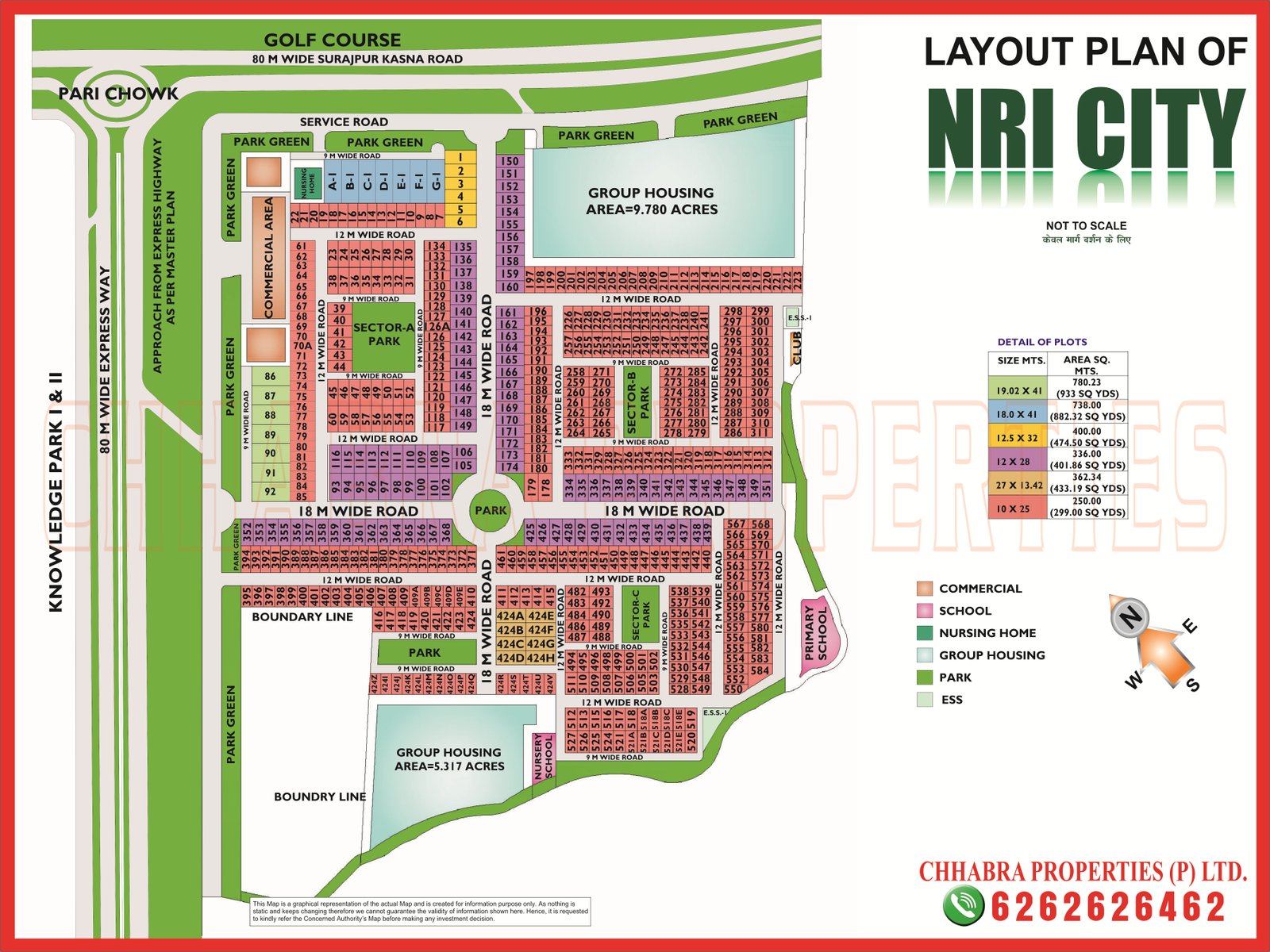
NRI City Greater Noida map explained: six plot sizes from 250 to 780 sq m, two group housing sites, parks, schools, Pari Chowk access and free map PDF.

Sector 10 and 12 Greater Noida map explained: group housing plot sizes in hectares, MP commercial area, 80 m and 130 m roads, villages and free map PDF.

Sector 1, 2, 3 and 4 Greater Noida map explained: plot sizes in Sectors 2 and 3, group housing in Sectors 1 and 4, villages, 130 m road, commercial belts and PDFs.

Sector 16B and 16C Greater Noida map explained: group housing plot numbers and acreage, project names on the plan, 130 m road, commercial belts and free map PDFs.
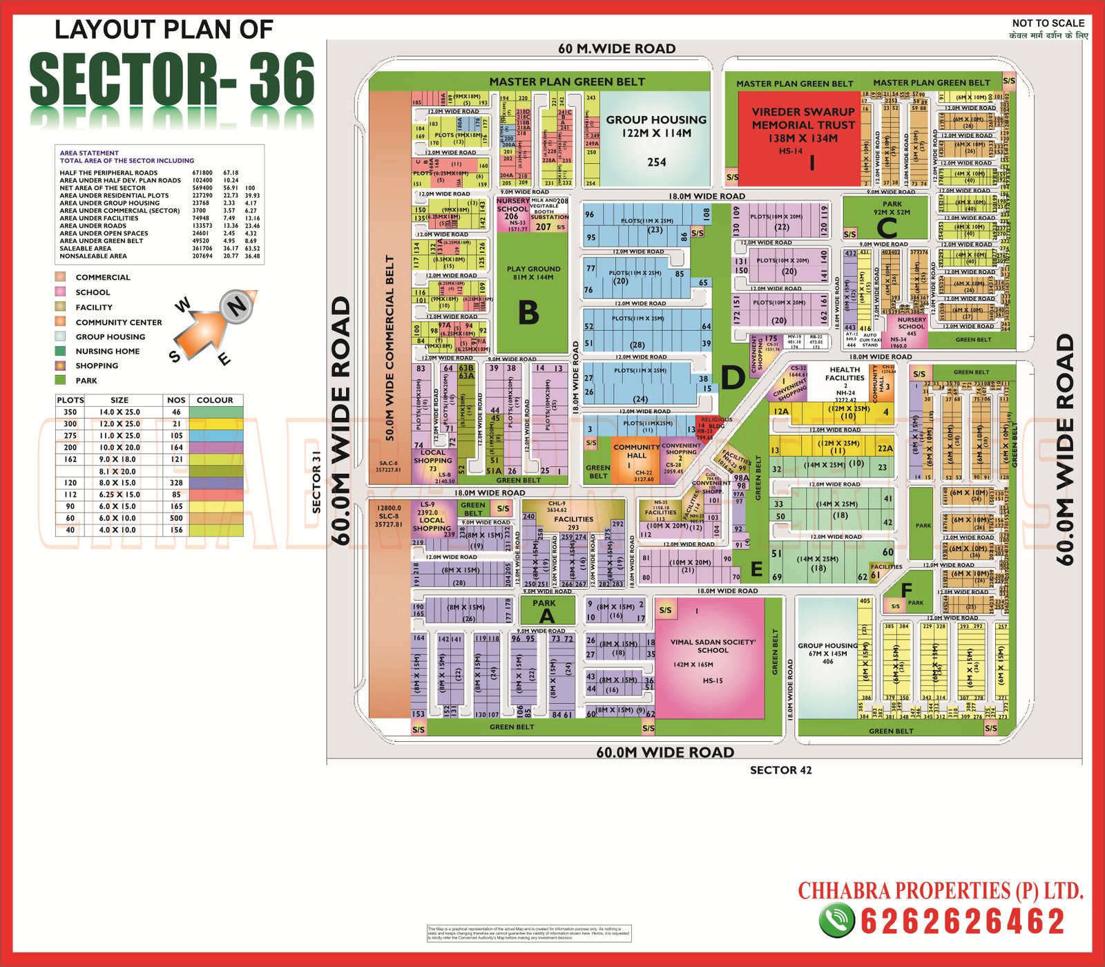
Sector 36 and Sector 37 Greater Noida map explained: ten plot sizes in Sector 36, 120 and 200 sq m plots in Sector 37, school sites, commercial belts and free PDFs.

Swarn Nagri (Sector 31) Greater Noida map explained: 1,161 plots of 200 and 288 sq m, blocks A to D, higher secondary school, group housing and free map PDF.
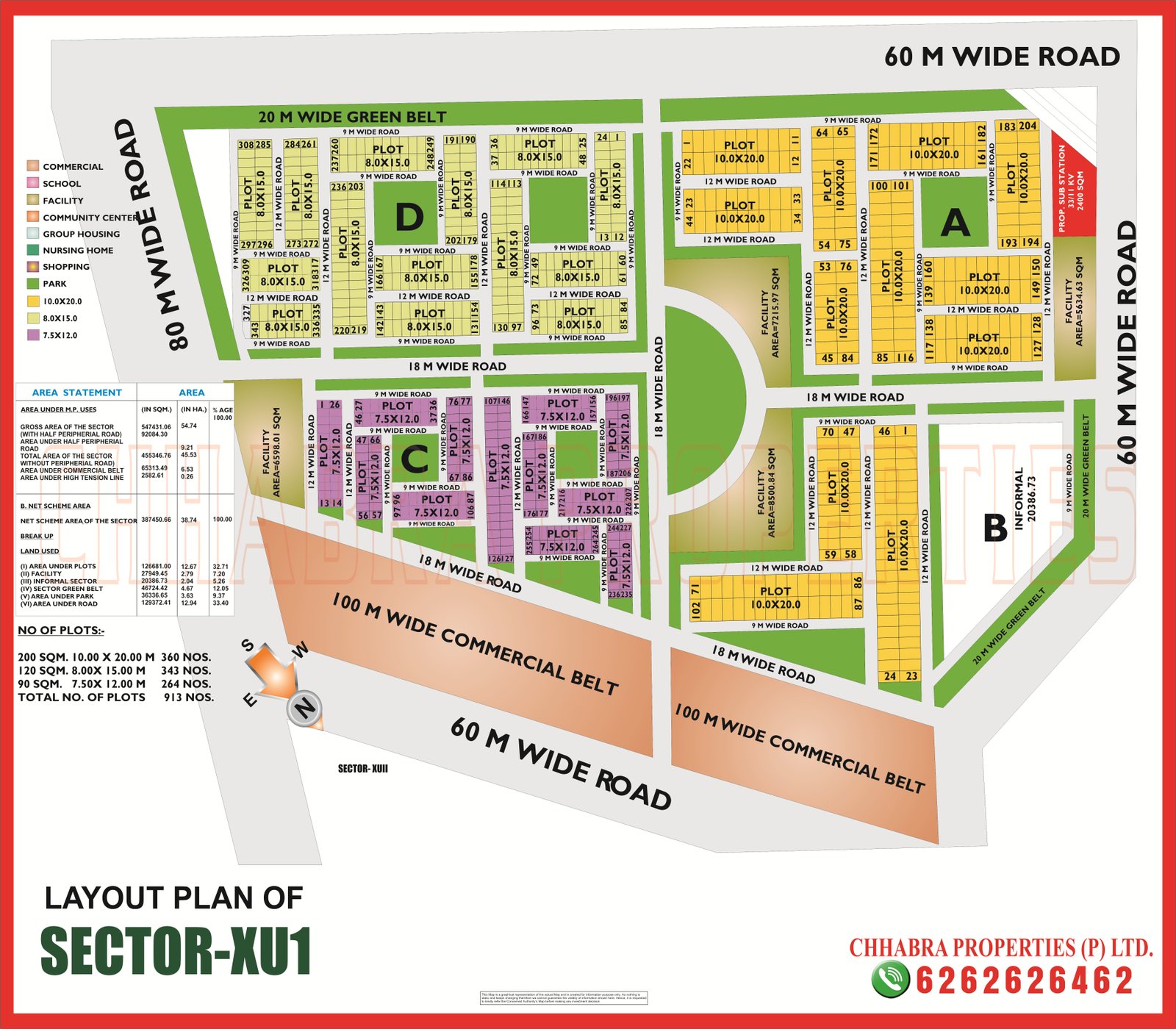
Xu 1, Xu 2 and Xu 3 Greater Noida map explained: 913 plots in Xu 1, 1,517 plots in Xu 3, 100 m commercial belts, village abadi areas and free map PDFs.
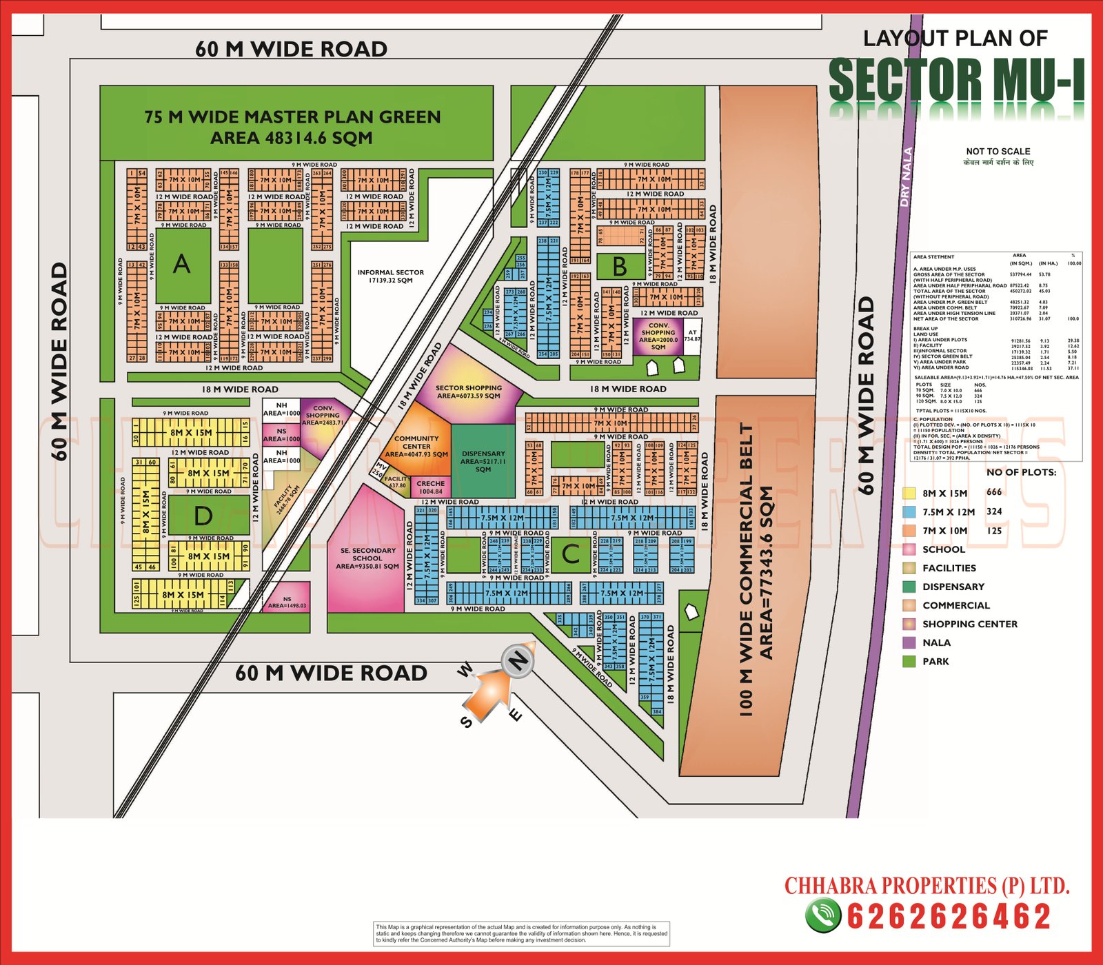
Mu 1 and Mu 2 Greater Noida map explained: 1,115 plots in Mu 1, 100 m commercial belt, school and facility sites, Mu 2 group housing and abadi, free map PDFs.

Mu Greater Noida map explained: two group housing plots of 61 ha, 100 m commercial belt, facility pocket, 60 m roads, planned population and free map PDF.

 WhatsApp