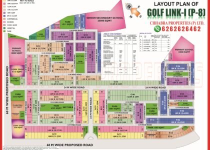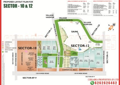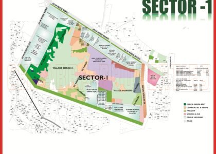
This Greater Noida Map guide explains the plots, roads and facilities in detail. Sigma 3 and Sigma 4 are the newer, more compact Sigma sectors. Unlike Sigma 1 and Sigma 2, they use small 200 to 220 sq m plots grouped into named estates, with large group housing plots, broad green belts and very wide commercial belts along the main roads.
This guide reads both official layout plans: plot sizes, estates, group housing, parks and roads. The map pages are on our Sigma 3 map page and Sigma 4 map page.
Sigma 3 and Sigma 4 Sector Maps
Both layout plans are shown below. Click either image to open the full-size map, or download the PDFs to read plot numbers.


Sigma 3: 348 Plots in Two Estates
The Sigma 3 plan states a total of 348 plots, all 20 m × 10 m (200 sq m, about 2,153 sq ft), split between two estates:
- Cassia estate (orange) on the west side.
- Nodola estate (yellow) in the centre and east.
Below the estates sit two large group housing plots of 2.96 ha and 4 ha, both planned at 243 persons per hectare, with a row of facility sites between them — a nursery school, creche, nursing home and convenience shopping. Roads and boundaries:
- An 80 m wide road corridor on the north.
- 60 m wide road corridors on the east and south.
- A proposed 60 m road with a 40 m green belt on the west.
- Two 50 m wide commercial belts (1.27 ha and 1.15 ha) along the east road.
- 45 m wide green belts below the group housing and several parks of 0.31 to 0.88 ha inside.
Sigma 4: Three Estates Around a Central Park
Sigma 4 uses a slightly bigger plot, 20 m × 11 m (220 sq m, about 2,368 sq ft), across three named estates:
- Austonia estate (salmon) in the north-east.
- Chorosia estate (yellow) in the north-west.
- Cassia Semia estate (purple) in the centre-west.
| Feature | Sigma 4 plan |
|---|---|
| Group housing | 3.45 ha and 5.3 ha at 299 persons per hectare |
| Central park | 1.74 ha, plus parks of 0.65 ha and 0.54 ha |
| Commercial belts | 100 m wide, 2.66 ha and 3.74 ha, along the east |
| Green belts | 75 m wide on the west (2.08 ha and 2.16 ha); proposed 45 m belts in the south |
| Main roads | 130 m road on the east, 80 m on the north, 60 m on the south and west |
| Neighbours | Sigma 2 to the north, Sigma 3 to the west, Sigma 1 to the north-west |
A small facility zone in the middle carries a nursery school, nursing home, convenience shopping and a creche.
Sigma 3 vs Sigma 4: Quick Comparison
| Feature | Sigma 3 | Sigma 4 |
|---|---|---|
| Plot size | 200 sq m (20 m × 10 m) | 220 sq m (20 m × 11 m) |
| Estates | Cassia, Nodola | Austonia, Chorosia, Cassia Semia |
| Group housing | 6.96 ha across two plots (243 PPHA) | 8.75 ha across two plots (299 PPHA) |
| Commercial belt | 50 m wide | 100 m wide |
| Widest road | 80 m | 130 m |
Sigma 4 has the wider commercial belts and the 130 m road, so it is the better pick if you value long-term commercial potential. Sigma 3 has a slightly smaller plot and a lower group-housing density. For bigger plots, look at Sigma 1 and Sigma 2.
What to Check Before You Buy in Sigma 3 or Sigma 4
- Confirm the estate name and plot number on the layout and in your papers.
- Check whether the plot faces a park, a green belt or a 12 m internal road.
- Note the proximity to group housing plots and drains shown on the plan.
- For Sigma 3, check the status of the proposed 60 m western road and green belt.
- Ask for the latest dues and possession status for the plot or project.
Sigma 3 and Sigma 4 on Google Maps
The pin below marks Sigma 3 on Google Maps so you can check distances to the main roads and Pari Chowk.
Explore Related Greater Noida Maps
- Sigma 3 map
- Sigma 4 map
- Sigma 2 map
- Sigma 1 map
- Sigma 1 Greater Noida map guide
- Sigma 2 Greater Noida map guide
Frequently Asked Questions
How many plots are there in Sigma 3?
The Sigma 3 plan states a total of 348 plots, each 20 m x 10 m (200 sq m).
What plot size is available in Sigma 4?
Sigma 4 plots are 20 m x 11 m (220 sq m) in the Austonia, Chorosia and Cassia Semia estates.
Do Sigma 3 and Sigma 4 have group housing?
Yes. Sigma 3 has two group housing plots (2.96 ha and 4 ha) and Sigma 4 has two (3.45 ha and 5.3 ha).
Which roads surround Sigma 4?
A 130 m wide road on the east, an 80 m road on the north and 60 m roads on the south and west.
Use this Greater Noida Map together with the official layout plan, and verify plot numbers and road widths with the Greater Noida Authority before you decide. The Greater Noida Map above is a reference guide for planning your visit.
Anyone comparing plots should read the Greater Noida Map alongside the nearby sector plans. Each Greater Noida Map page on this site lists plot sizes, road widths and facility sites, so you can shortlist the right plot with confidence.
Need the Latest Sigma 3 or Sigma 4 Map?
Chhabra Properties helps buyers, sellers and investors with plots, houses, floors and flats across Greater Noida from its office in the Alpha 1 Commercial Belt. Ask us for the latest layout, availability and current rates.
Office: 204, S L Tower, Alpha-I Commercial Belt, Greater Noida, Uttar Pradesh 201310